Карта Интернета
Карта Интернета
1977[править | править код]

1979 Арпанет[править | править код]

1982 Постел[править | править код]

1986 BBN[править | править код]

2003 Opte[править | править код]
OPTE — частный проект по измерению и визуализации всего Интернета в разные годы. Например, The Internet 2003
«Это наша первая полная карта Интернета с цветом и другой логикой построения графиков. Адреса RFC1918 были преобразованы в уникальную контрольную сумму, чтобы они некорректно не пересекались с другими маршрутизаторами или хостами. Контрольные суммы каждый раз передаются одному и тому же хосту, чтобы убедиться, что все маршруты подключены правильно. В другом фрагменте кода также были удалены циклы маршрутизации, которые вносили довольно большой беспорядок в предыдущие карты. Цвета были основаны на распределении IP-пространства класса A для разных регистраторов в мире».
2010 Opte[править | править код]
«Это изображение никогда не публиковалось публично до 2014 года. Его можно было увидеть только в Музее современного искусства (МоМА) в Нью-Йорке и в выпуске журнала Discover. Это первая версия изображения, отрисованного с использованием BGP в качестве точек данных, а не необработанных трассировочных маршрутов. Это значительно отличается от исходных изображений traceroute и, как следствие, обеспечивает основу для будущих и прошлых изображений на основе архива данных таблицы видов маршрутов. Выбор цвета основан на цвете свечения, где большинство точек подключения соответствуют самым высоким температурам с точки зрения цветов свечения».
2014[править | править код]
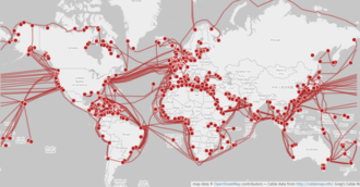
- Как выглядит карта всех устройств на планете, подключённых к Интернету (Shodan) + анимация: Как меняется активность интернета в течение суток (Relative IPv4 utilization observed using ICMP Ping requests) (Carna Botnet) + Где лежит интернет под водой
2015 Opte[править | править код]

2015 Подводные кабели[править | править код]
Карты отдельных сетей[править | править код]
Ссылки[править | править код]
- Сайт Opte: https://www.opte.org/the-internet/ "The Internet IPv4 vs IPv6 "
- МИРОВАЯ КАРТА ИНТЕРНЕТА - 85 ФОТО


